Property Past

Tricky, sticky stories arise at the sight of buildings in the landscape. Evidence (or absence) of us along the way.

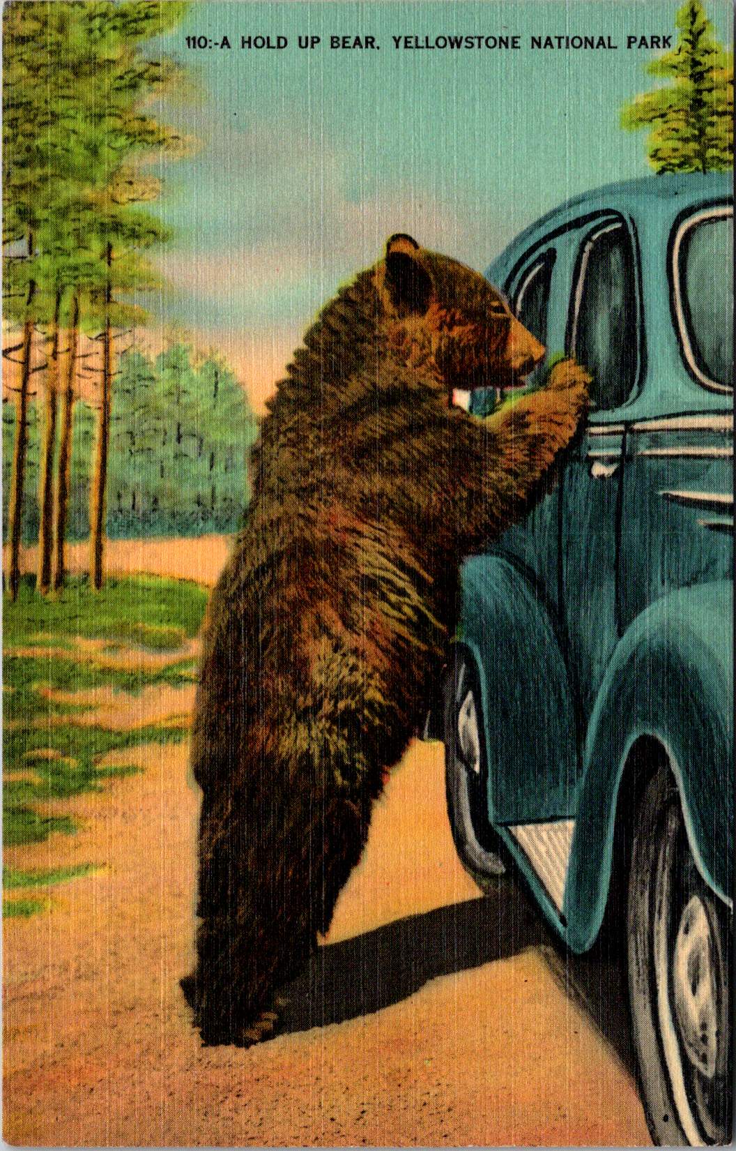
As landscapes, last week’s real photo postcards (RPPC) asked for nothing. Trees, frozen roads, animals burrowing in snow—they floated free of context. We could easily appreciate them without knowing where they might be.

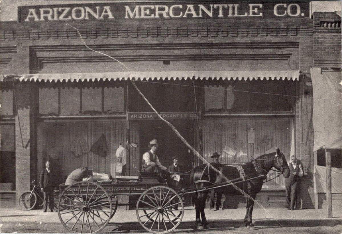
Buildings are different. A structure says someone decided, planned, risked, and accomplished. They hauled materials, drove nails, painted trim. Buildings demand explanation in ways that hills might easily demure.

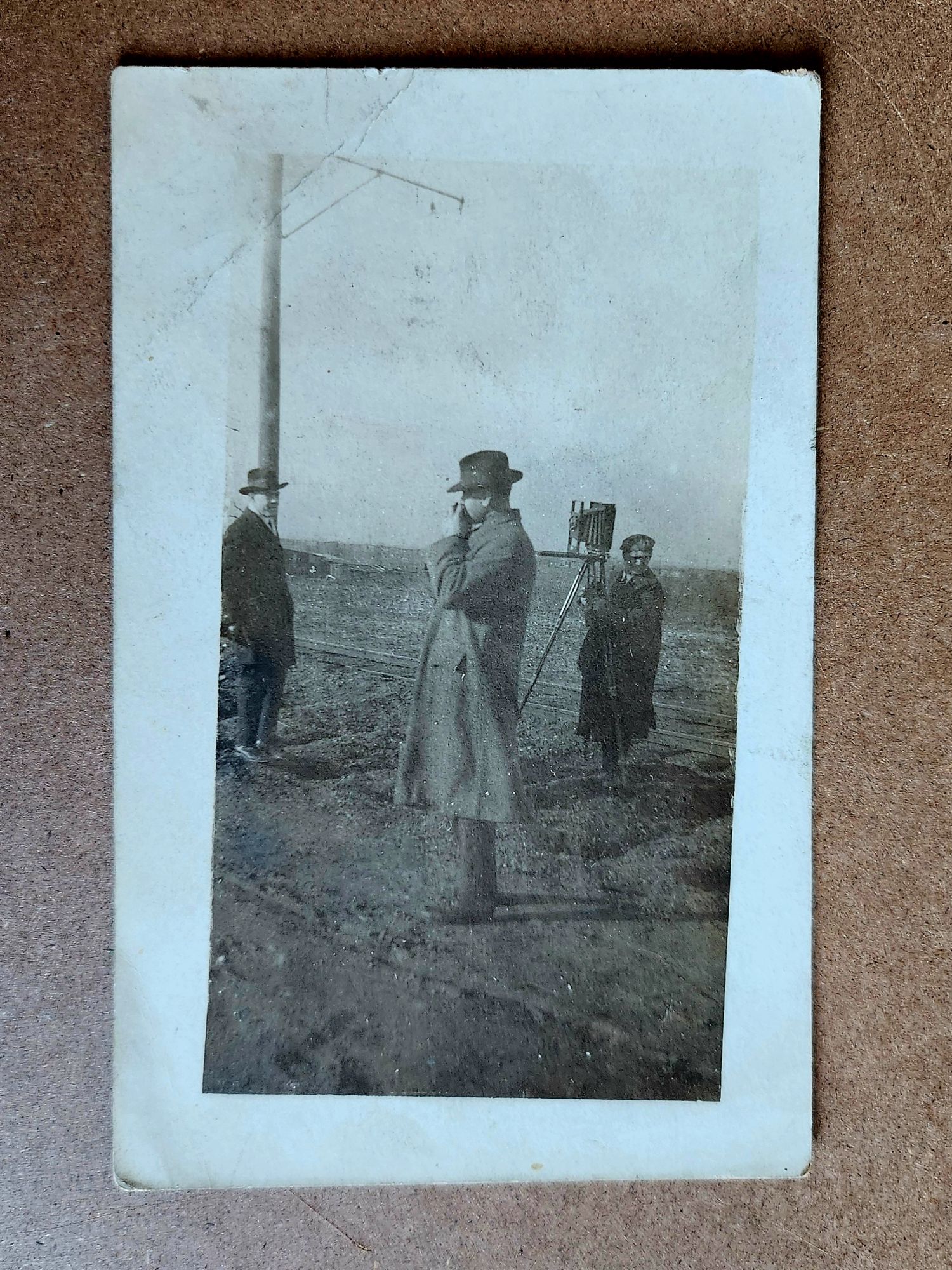
Reading postcards slowly reveals patterns. The undivided back means pre-1907. The real photo process suggests a local photographer, or maybe an itinerant professional documenting a place too remote to the reach of commercial postcard companies. Paper stock, indicia, stamps and cancellation, faded handwriting and previous labeling, even image placement and crop—these technical details narrow the place possibilities.

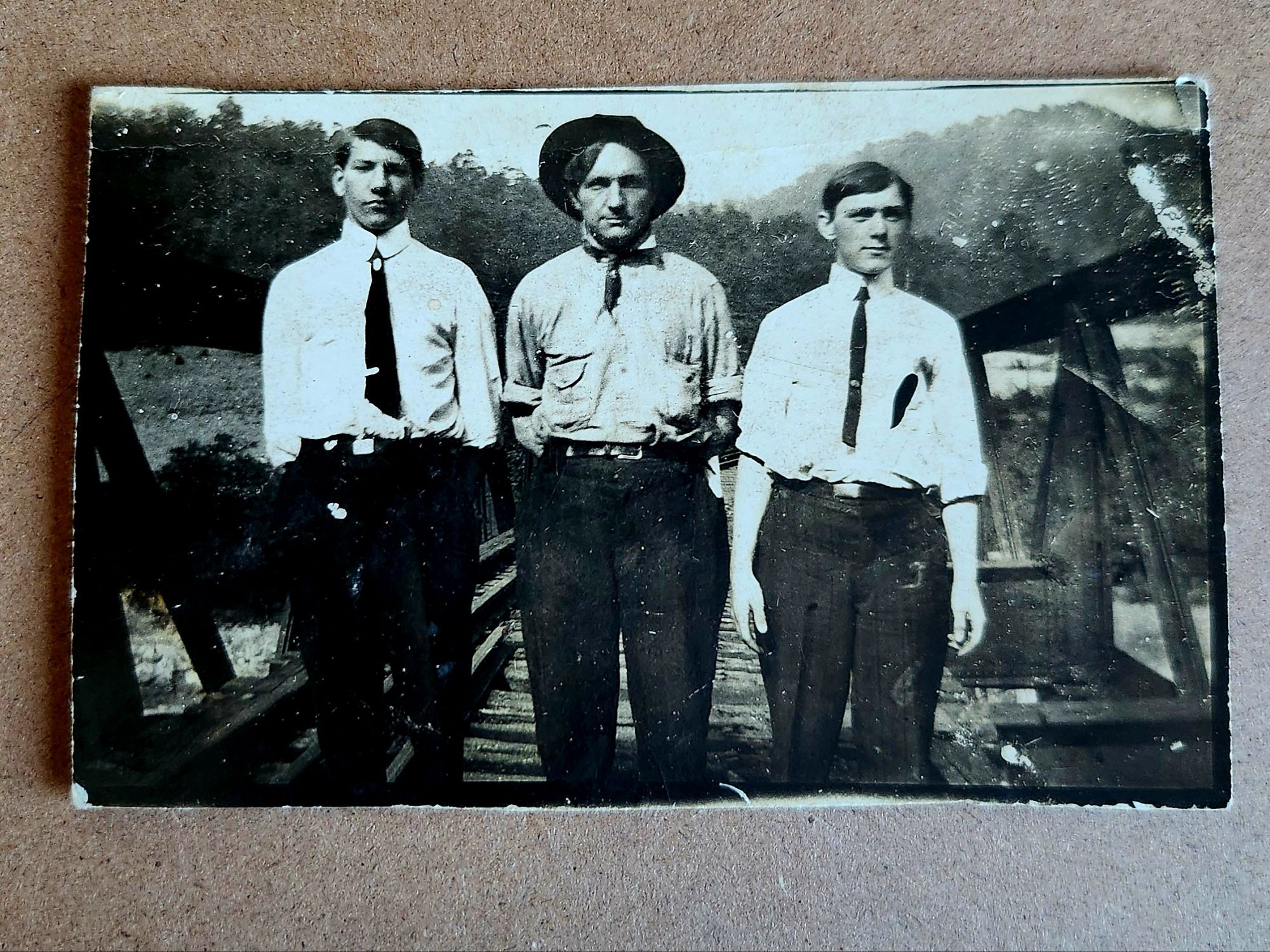
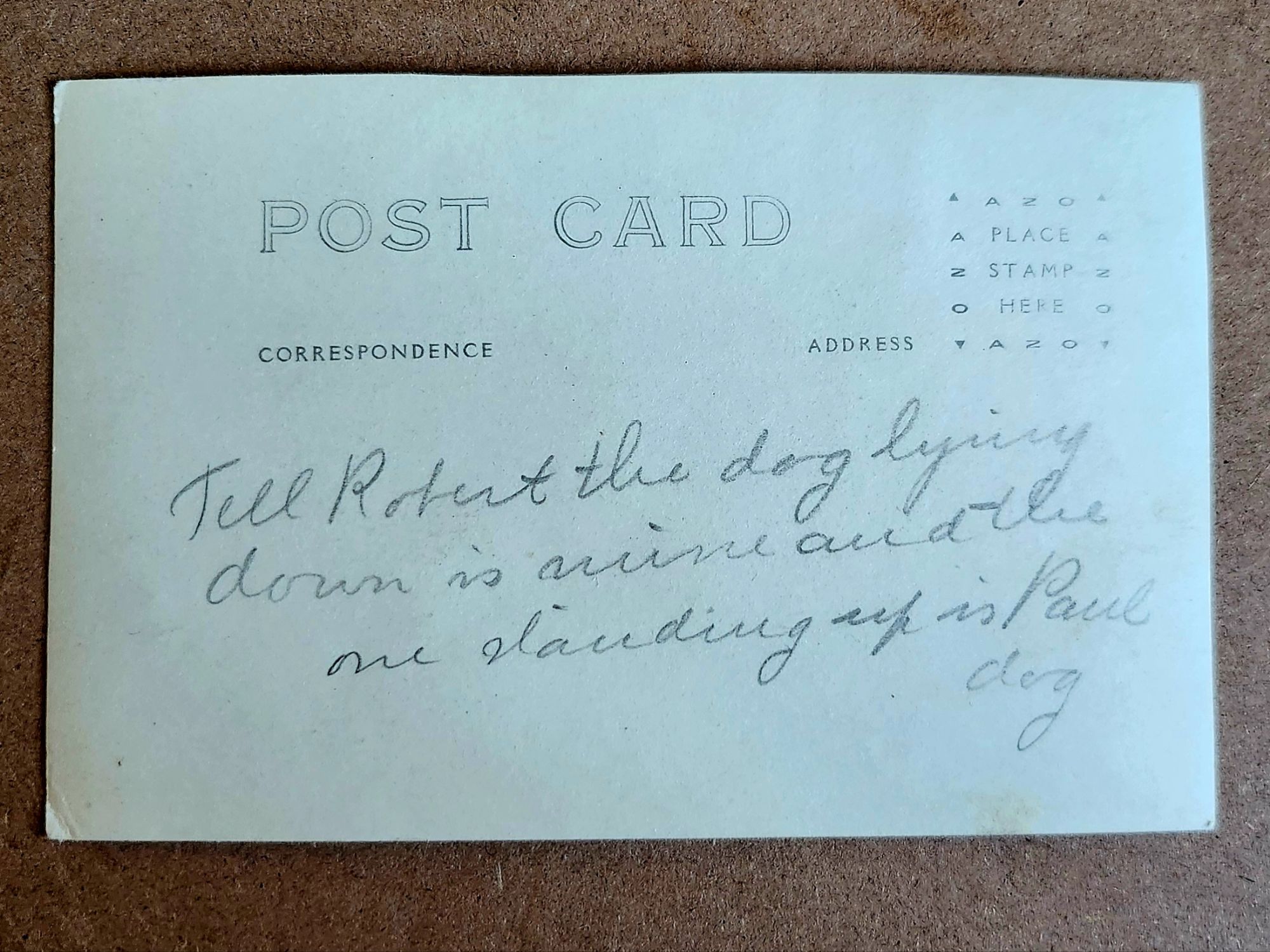
But they don’t yet answer another question: Who are Robert and Paul?

Tell Robert the dog lying down is mine and the one standing up is Paul dog

What We Might Know

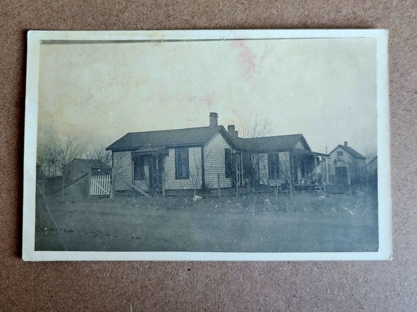
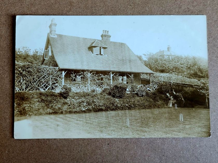
A two-story house with a generous porch is carefully centered in one photograph. Mature trees in the foreground. Curtains hang in the windows. Someone lived here and wanted to show their pride. Or, was it for sale?

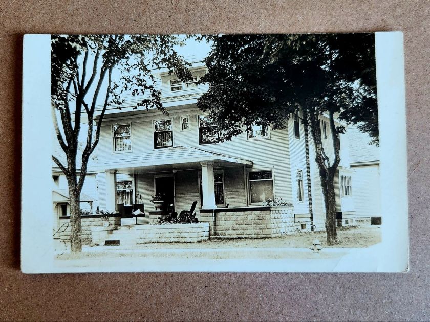
The architectural details offer more clues. Clapboard siding, stone or brick foundation, decorative porch elements—not fancy, but intentional. It seems to be in a neighborhood with sidewalks. In an era between 1900-1920, somewhere in the Midwest or West judging by lot size. Also, a fire hydrant.

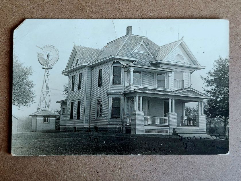
The windmill in another image dates itself. Windmills were an important utility and industry, and that style had a particular era. The house beneath it—elaborate Queen Anne with corner turret, ornamental shingles, and ornate columns—speaks to aspiration. Someone had big plans. This is visible evidence. When and where becomes roughly recognizable.

But, the people who stood on that porch remain absent and enigmatic. Who were they? What is happening here? A creative tension is mounting between the realm of evidence and the pull of story.

Sensing Stories

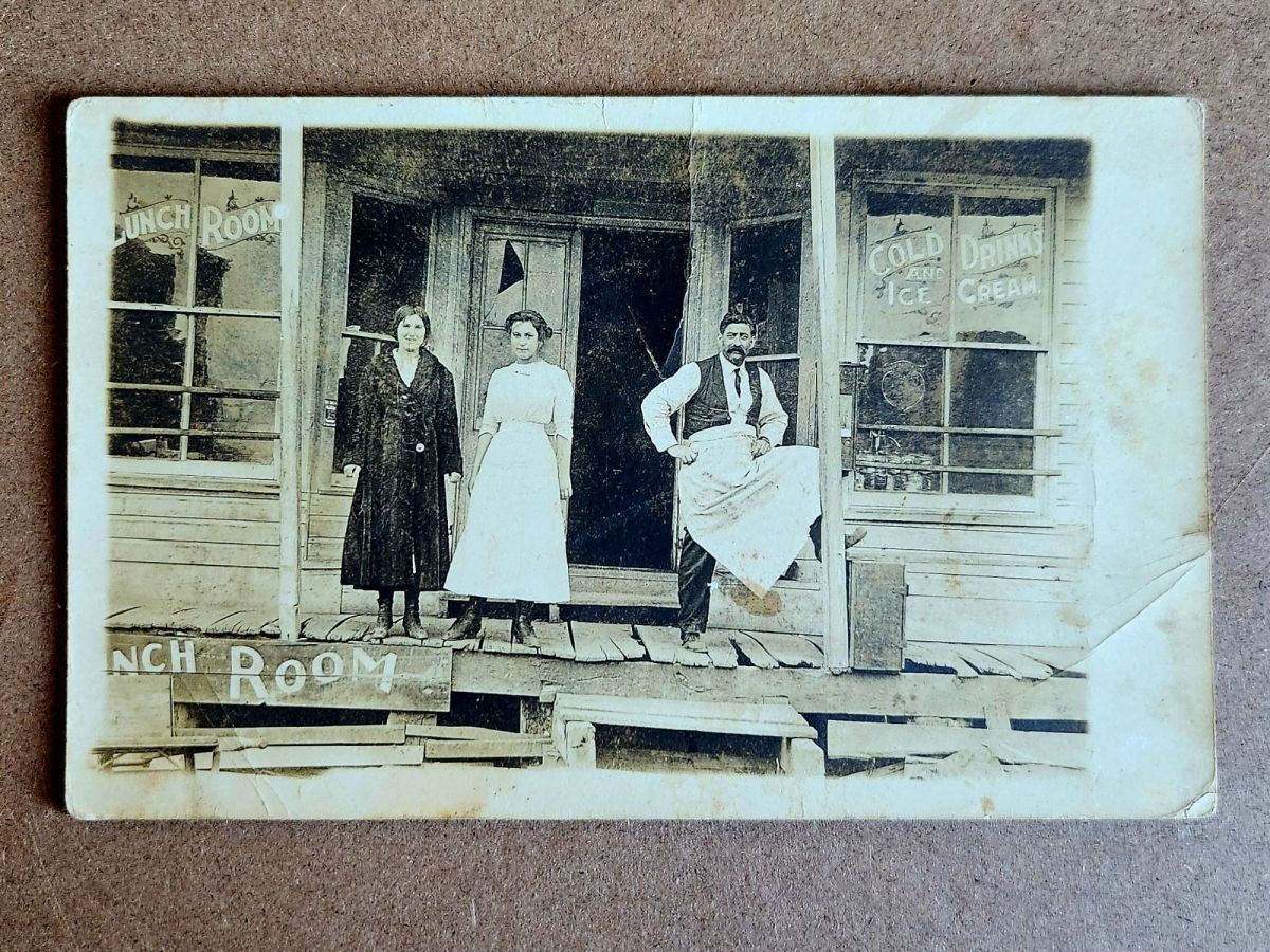
Two women stand in front of McMann Boarding House wearing identical striped dresses. The building is simple—board and batten, minimal trim, the kind of structure that goes up first and fast in a growing place.

The photograph has a vertical tear, the exposure is bad, and time has degraded it. But the sign remains legible: McMann Boarding House. Finally, a name.

Who was McMann? Who are these women? Employees? Vacationers? The photo is both casual and deliberately staged. What might the matching dresses mean? Pride? Subjugation?

Reading their faces, we fill in the narrative, almost immediately and sometimes inescapably. Relationships, motivations, futures take shape unbidden. This is exactly what we both invited and warned of last week—making it up. Always dangerous, sometimes worthwhile.

The impulse to story is nearly irresistible. A name on a building. Two women in matching dresses. The space around the postcard lights up. Are these their stories, or our own, or a magical projection that folds time?

When the Past Chats Back

Shuffling the stack, several cards in this collection start speaking to one another. Same photographic quality. Same paper stock. Similar landscape—flat, spare, newly broken. And most telling: similar structures in states of becoming.

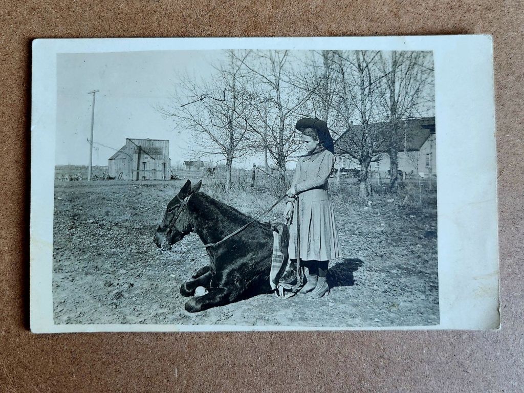
Laid out together, the pattern emerges. Houses with stone foundations and wraparound porches. An elaborate Queen Anne with a windmill. McMann Boarding House with its two women in matching stripes. A lunch room with an immaculately vernacular grand porch. Best-dressed proprietors standing proud. A girl and her horse, bare buildings behind her. A picnic under the canopy of a large tree.

Also, a massive plume of black smoke billowing skyward, an oil derrick to the left, eight or nine men grinning toward the camera. The photograph stops everything cold. They struck liquid gold. A triumph worth documenting. Fine lines of the plumes etching through the darkest black.

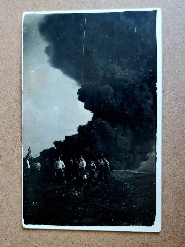
These eleven images are a cluster from the same story—a town emerging around oil. Homesteaders and entrepreneurs arriving in a place that may have been open prairie five years earlier. Building homes, businesses, infrastructure for both industrial productivity and social life. Documenting the process with real photo postcards, for themselves or to send East. Their message: we have arrived safely and are in luck.

From Here to Now

This is a founding, the moment a place began and the stakes changed. These aren’t isolated buildings anymore and oddly they seem less like photos, too. We know there is a community taking shape and the evidentiary questions multiply. Who were they, by name? What brought them here? Did this place survive or vanish?

And harder, deeper, more consequential questions: Who lived here before? What animals and habitats were displaced? What did the derricks do? For them, and also to us.

Boom town logic. Extraction economy. Infrastructure dependencies and family injuries inherited. Cultural degradation, and environmental costs still being paid. This isn’t quaint history. This is the beginning of something we’re grappling with today.

Suddenly our imaginative stories contract and we now seek facts. The boarding house proprietor’s daily life can be imagined, but not separated from a place built on oil speculation. The architectural ambition of that Queen Anne deserves appreciation, but it went up in a town that might have lasted ten years or a hundred, depending on the wells. The buildings aren’t innocent, and we are implicated.

More in Store

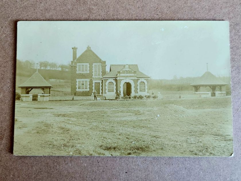
Another stack of postcards might be related to this cluster—similar age, similar style, possibly the same region, likely at later dates. And then a few unrelated ones, probably European based on the architecture.

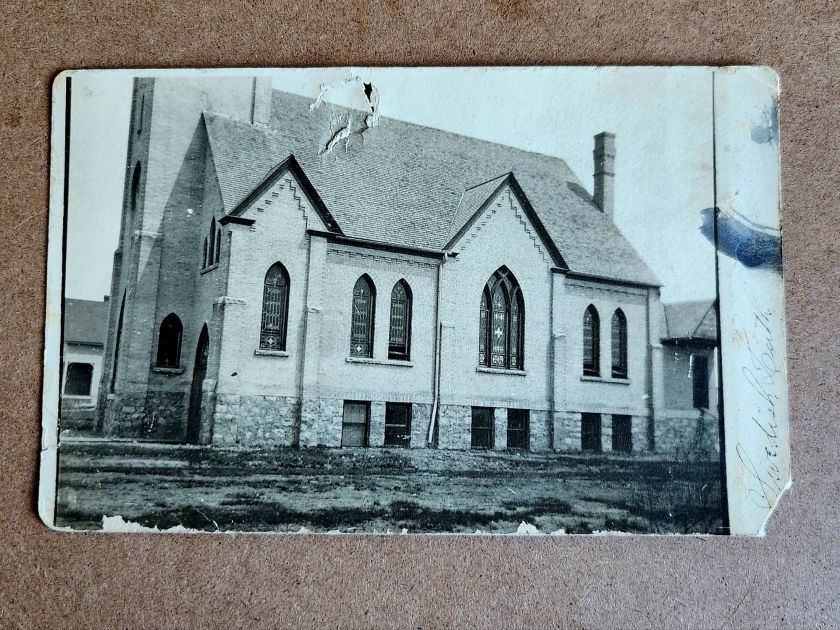
Not every fragment connects or resolves. Some buildings will remain singular, their stories unrecoverable. Churches and homes, beautiful structures, carefully photographed. Loved locally today as a memory or a ruin, perhaps.

Not everything needs a narrative. Some images can just be enigmatic. Evidence of care, of craftsmanship, of a moment someone thought worth preserving. These evocative details lead to fiction, which makes its own case for history and the preservation of minute detail.

But this cluster won’t let go. They connect to another stack, and soon we’ll know more. Next week we’ll meet the people themselves, looking back at us.

Panoramic Phoenix

Rare panoramic postcards from the Haines Photo Company capture Phoenix on the cusp of the century.

As American cities boomed in the early 1900s, panoramic postcards emerged to document their transformation. The Haines Photo Company of Conneaut, Ohio seized this opportunity, operating from about 1908 to 1917. Photographers crisscrossed the country capturing these distinctive wide-angle views of evolving American cityscapes, like Phoenix, a fledgling desert outpost poised for dramatic growth.

Phoenix in 1900 numbered just 5,554 residents. Though small, it already served as Arizona’s territorial capital with statehood just twelve years away. These panoramic postcards reveal a city establishing the foundation for its explosive future growth.

Washington and First Streets

The first panorama captures Phoenix’s commercial core at Washington and First Streets. Electric streetcar tracks cut through the unpaved road—these trolleys had replaced horse-drawn versions in 1893, modernizing city transit. Desert mountains loom in the distance while palm trees line parts of the street, evidence of successful irrigation in this arid landscape.

A prominent building with a tower dominates the background. Pedestrians stroll the sidewalks alongside horse-drawn carriages, as automobiles remained rare luxuries. Sturdy two and three-story commercial buildings reveal a city with ambitions beyond its frontier origins.

Residences at Center and McKinley

The second view shifts to Phoenix’s growing residential district at Center and McKinley. Here, successful merchants and professionals built impressive homes along wide, unpaved streets. Both palm trees and deciduous trees (some leafless in winter) frame the elegant residences.

These neighborhoods developed as streetcar suburbs, allowing prosperous residents to escape downtown congestion while maintaining business access. Homes display fashionable Colonial Revival and Craftsman styles with generous porches and elaborate details. Unlike cramped eastern cities, Phoenix boasted detached homes on spacious lots—a pattern that would define its future growth.

Washington and Second Avenues

The third panorama returns us to the commercial district. A substantial three-story building with multiple balconies dominates the left side. Was it a hotel or major retailer? Streetcar tracks again slice through the broad dirt roadway. A park or green space appears across the street, providing rare desert shade.

Notice the shadow intruding on the lower left? It’s the silhouette of our photographer with tripod-mounted camera. Was this F.J. Bandholtz, a prominent panoramic photographer who worked with Haines?

Washington and First Avenues

The fourth panorama captures Phoenix’s financial center. A four-story brick building with numerous arched windows dominates the scene. This building houses the Phoenix National Bank with law offices above, very likely belonging to Joseph H. Kibbey, a former Territorial Supreme Court Justice (1889-1893) and Arizona Territorial Governor (1905-1909).

Founded in 1892, the Phoenix National Bank had become Arizona’s largest by 1899, with deposits totaling $692,166. Telegraph and electrical poles with multiple crossbars line the street, demonstrating developing infrastructure. The dirt streets accommodate both pedestrians and horse-drawn vehicles, though automobiles were beginning to appear.

Capitol Grounds

The fifth panorama showcases Arizona’s territorial capitol. This impressive domed structure, completed in 1900 at a cost of $130,000, sits back from the road on a donated 10-acre plot at Washington Street’s western end. Formal gardens with cypress, palms, and ornamental plantings surround the building, irrigation transforming these arid landscapes.

Governor Murphy dedicated the building on February 25, 1901. At the time, the capitol complex embodied Phoenix’s civic ambitions and push toward statehood. Now the main building is home to the Arizona Capitol Museum, connecting present-day Phoenix to its territorial roots.

Phoenix Indian School

The final panorama depicts the Phoenix Indian School campus with its multiple buildings, some with smoking chimneys, surrounded by palm trees. Established in 1891, this federal boarding school implemented the government’s brutal and coercive Native American assimilation policies. Located on 160 acres north of downtown, the campus featured brick and frame buildings for classrooms, dormitories, workshops, and administration.

The school expanded rapidly from 42 students initially to 698 by 1900, representing 23 tribes from across the Southwest. Operating until 1990, the school’s complex history reflects the often painful relationship between the federal government and Native peoples, and Phoenix’s role in executing national policies.

The Haines Photo Company

These remarkable panoramic images came from the Haines Photo Company of Conneaut, Ohio. From 1908 for about a decade, they specialized in wide-angle photography of towns and cities across the United States. The Library of Congress preserves over 400 of their photographs documenting America’s evolving landscapes and cityscapes.

Technological innovations in cameras and film made panoramic photography possible. Companies like Haines used specialized equipment to capture expansive views with exceptional clarity. They printed these as postcards for both tourists and locals proud of their developing communities. The panoramic format perfectly suited sprawling western cities like Phoenix that grew horizontally rather than vertically.

Who actually pressed the shutter remains mysterious. The Library of Congress identifies F.J. Bandholtz (Frederick J. Bandholtz, born circa 1877) as a prominent panoramic photographer working with Haines. The shadow in the third image provides our only glimpse of the person behind the camera—a tantalizingly incomplete clue to their identity.

Fast Growth in Phoenix

The early 1900s transformed Phoenix through several key developments. Roosevelt Dam (completed 1911) secured reliable water and power for the Valley. The Santa Fe, Prescott and Phoenix Railway (1895) connected the city to northern Arizona while streetcars improved local mobility. Institutions like the Carnegie Free Library (1908) and Phoenix Union High School (1895) established cultural foundations. Economic activity diversified beyond the “Five Cs” (copper, cattle, climate, cotton, and citrus) to include banking, retail, and professional services.

Statehood on February 14, 1912 elevated Phoenix’s status as capital. These postcards hint at those century-old aspirations—a frontier town rapidly becoming a modern American city. Phoenix’s population doubled from 5,554 in 1900 to 11,134 by 1910, and surged to 29,053 by 1920, launching a growth trajectory that would eventually make it one of America’s largest cities.

A Tale of Two New Deals

Old Faithful Inn stretches across the Yellowstone landscape, its distinctive roofline echoing the forested hills in a vintage linen postcard. Steam rises from the nearby geyser basin. The Civilian Conservation Corps built Yellowstone for their time and for future generations. In New York, a sister program blazed trails, too.

The story of our national parks is also a remarkable story of resilience and collaboration in hard times. Just as the national parks were becoming popular, the Depression brought unprecedented unemployment and bare scarcities at home, on the farm, and in cities. Leaders with optimistic vision were challenged to engage an illiterate and unskilled workforce or face severe cultural, social, and economic consequences.

The Civilian Conservation Corps’ work in Yellowstone exemplified an unprecedented partnership between federal agencies, orchestrated by a remarkable team. Robert Fechner, the program’s first director, brought his labor union experience to balance competing interests that might have limited the program. Harold Ickes, as Secretary of the Interior, ensured high standards for conservation work. The Department of Labor selected the men for service in the corps. The Army constructed and operated the camps. The National Park Service and Forest Service supervised the technical and construction work. This complex dance of bureaucracy somehow produced remarkable efficiency, with the CCC completing projects that had languished on drawing boards for decades.

Take the terraced formations of Mammoth Hot Springs, for example, their delicate travertine steps descending the hillside in nature’s own architecture. CCC workers constructed the stone steps and walkways that would allow visitors to safely view these natural wonders. The careful integration of human infrastructure with natural features became a hallmark of CCC work. Now known as ‘parkitecture’, the philosophy would influence park design for generations.

Long before the federal programs, Frances Perkins coordinated closely with Roosevelt during his New York state governorship to protect workers and grow the workforce. She had witnessed the Triangle Shirtwaist Factory fire in 1911, an experience that drove her lifelong commitment to worker safety and labor reform. As New York’s Industrial Commissioner from 1929 to 1933, Perkins pioneered unemployment relief programs and worker protections that would later shape New Deal policies. When Roosevelt became president, he named her Secretary of Labor – the first woman to serve in a presidential cabinet – and she brought her New York experiences to Washington just in time.

Perkins understood the value of both job creation and job training, having seen their impact in New York. She helped shape the CCC, carefully navigating the political tensions around women’s employment programs. Her influence helped ensure that CCC and other programs included educational components, reflecting her belief that economic relief should build long-term capabilities, not just provide temporary aid. She also made sure the federal programs benefited her home state, and piloted important new programs there.

A 1905 hand-colored postcard of Watkins Glen in New York state shows Diamond Falls in the distance, framed by the narrow gorge’s layered rock walls. When the CCC arrived here in the 1930s, they found a park already famous for its natural beauty but in need of significant infrastructure. The Corps constructed the stone walkways that still guide visitors through the glen today, built overlooks at strategic points, and created a trail system that made the park’s dramatic features accessible while preserving their natural character.

The CCC’s work at Watkins Glen was particularly challenging given the varied landscape and unique natural formations. Jacob’s Ladder, a daunting stone staircase ascending the gorge wall, required precise engineering to integrate it naturally into the rock face. The Corps workers quarried stone and shaped the ascent, creating a path that appear to emerge organically from the cliff itself.

At Rainbow Falls, they constructed the “flying stairs” – suspended pathways that seem to float alongside the cascading water. This required not just skilled stonework but innovative engineering to ensure the structures could withstand the gorge’s frequent flooding and harsh winters. The Stairway to Lover’s Lane presented similar challenges, with workers having to carefully cut into the gorge wall while preserving its natural beauty.

The Corps also built the park’s amphitheater, transforming a natural hollow into a gathering space that would host generations of visitors for educational programs. Throughout these projects, workers had to move tons of stone while working in the confined space of the gorge. They developed specialized techniques for working in the narrow spaces, often suspended above the creek as they built pathways that had to withstand both regular flooding and freezing temperatures. The project showcased the Corps’ ability to combine heavy construction with delicate environmental consideration – skills that would prove valuable throughout the park system.

Yet while young men were building parks across America, another story was unfolding at Bear Mountain, New York. A smaller program called the Temporary Emergency Relief Administration (TERA) – nicknamed the She-She-She camps – was offering women their own opportunity for training and education. Eleanor Roosevelt championed this effort, collaborating closely with progressive educator Hilda Worthington Smith to create a program that emphasized both practical skills and broader education.

At Camp TERA, women learned furniture refinishing, bookbinding, typing, and business skills. They studied literature, current events, and public speaking. The curriculum reflected both practical needs and progressive educational ideals, emphasizing peer learning and leadership development. The camps created a college-like atmosphere, quite different from the military structure of CCC camps.

The economics of these programs tell their own story. Spending roughly $1,000 per enrollee annually (about $25,000 in today’s dollars) the CCC cost $3 billion over nine years – equivalent to about $60 billion today. In its time, the program returned an estimated $2.50 in measurable public benefits for every dollar spent. Each CCC enrollee earned $30 monthly, with $25 sent home to their families – enough to keep many families fed during the Depression’s darkest days. The TERA budget was much less and never achieved the scale that made the CCC so cost-effective, yet for some of the women who participated, the return on investment was significant in improving their health, caregiving capacities, and professional skill sets – many went on to careers in business, education, and public service.

The CCC employed three million men over nine years. TERA participants numbered just 8,500 women. Despite Eleanor Roosevelt’s advocacy and Frances Perkins’ support from the Labor Department, the women’s program expanded only briefly and never really got off the ground. The reasons echo familiar themes: limited funding, resistance to women working outside the home, and debates about appropriate roles for women in society.

These limitations weren’t unique to TERA. The CCC itself reflected America’s racial divisions, with segregated camps and discriminatory selection. Some local communities opposed Black CCC camps in their areas. The program’s focus on young, single men also excluded many who needed help.

Yet for all their limitations, the New Deal’s public works programs transformed America’s public spaces. Beyond the CCC and TERA, the Works Progress Administration built parks, schools, and community centers nationwide. WPA artists created murals that still enliven post offices and courthouses today. Collectively, WPA workers built communities, developed national infrastructure, and documented American life through photography and collected folk songs and stories that might otherwise have been lost.

The human legacy of these programs extends far beyond their physical achievements. Chuck Yeager, the pilot who would later break the sound barrier, learned mechanics in the CCC. Stan Musial developed his work ethic in a Pennsylvania CCC camp before becoming a baseball legend. Robert Mitchum and Raymond Burr worked in CCC camps before their Hollywood careers. From the TERA camps emerged teachers, business leaders, and community organizers who shaped their communities for decades to come.

Looking at these vintage postcards today, we can measure the value of these programs not just in the enduring infrastructure they created, but in the generational impact of providing education and opportunity to millions of Americans of modest means. Think of the families fed by CCC wages, the skills learned, the confidence built. Consider the children and grandchildren who grew up hearing stories of carving out Yellowstone’s trails or getting the chance to study at Bear Mountain, who inherited not just the physical legacy of these programs but their spirit of public service and possibility. Think of all of us today, who still climb the steps and set our sights on this same legacy.

The trails around Old Faithful, the stone steps at Watkins Glen, the walkways at Mammoth Hot Springs – all have weathered nearly ninety years now, crossed by millions of visitors. They stand as monuments not just to American craftsmanship, collaboration, and ingenuity but to the transformative power of public investment in both our spaces and our people. They give us examples of leadership and also remind us of the great many unknown men and women who preserved and protected the places we love. Their endurance challenges us to imagine what might be achieved in this generation if we again dared to think so boldly about developing our natural resources and our human potential together.

Bridging Time: The Enduring Allure of Madison County’s Covered Bridges

Weathered wooden structures still stand in the middle of Iowa, a testament to both engineering ingenuity and the power of storytelling. The covered bridges of Madison County have become more than mere crossings over babbling creeks; they are portals to the past, muses for artists, and anchors for a community’s identity. As the crisp autumn air settles over the rolling hills in October, thousands of visitors gather to celebrate these iconic structures at the annual Covered Bridge Festival, a tradition that has endured for over half a century.

Our journey begins with a stack of old locally-printed postcards, each capturing a nearby rural scene frozen in faded grayscale tones. Photographed by Clee Crawford in the early 1950s, these images were made into postcards sometime after 1983 by Larry’s Photography and Joe Graham Printing in Winterset, Iowa. Vintage collectibles themselves, they offer a glimpse of a bygone era when the now-famous bridges were simply part of the rural fabric of Madison County.

The Roseman Bridge, built in 1883 by H.P. Jones, spans the Middle River nine miles southwest of Winterset. In the postcard, it rises from a sea of cornstalks, its wooden siding weathered by countless Iowa summers and winters. Known locally as “The Haunted Bridge,” it whispers of ghost stories told around farmhouse tables and hushed conversations between young lovers seeking shelter from prying eyes. Little did the bridge know that it would one day become a star, playing a pivotal role in a story that would captivate millions.

Moving northeast, we encounter the Cutler-Donahoe Bridge. Constructed in 1871, this structure originally crossed the North River. But like many of its counterparts, it found a new home as the winds of change swept through the county. In 1970, the same year the first Covered Bridge Festival was held, Cutler-Donahoe was carefully uprooted and transplanted to Winterset City Park. The postcard captures it in its original location, a sentinel standing guard over the river below, unaware of its future as a centerpiece of civic pride.

Our third postcard brings us to the Cedar Bridge, another creation of the prolific bridge-builder H.P. Jones. Erected in 1883 over Cedar Creek north of Winterset, it too would embark on a journey, moving to a new location in 1920. The image shows the bridge nestled in a picturesque rural setting, a dirt road winding its way to the entrance. What the postcard doesn’t reveal is the tumultuous future awaiting this particular bridge – a tale of destruction, rebirth, and the tenacity of a community unwilling to let go of its heritage.

The final postcard in our collection tells a bittersweet tale. The McBride Bridge, built in 1871, appears proud and sturdy in the photograph. Yet the caption reveals its fate: destroyed by fire on September 3, 1983. This loss, occurring on the first day of the 1983 Madison County Covered Bridge Festival, served as a stark reminder of the fragility of these historical treasures and the importance of preservation efforts.

The destruction of the McBride Bridge is, unfortunately, not an isolated incident. Across the United States, covered bridges have long been targets of arson and accidental fires. According to data compiled by Covered Spans of Yesteryear, over 670 covered bridges have been lost to fire nationwide since the early 19th century. In Iowa alone, at least seven covered bridges have succumbed to flames, with arson being a common cause.

The Cedar Bridge, captured so peacefully in our postcard, has had a particularly tumultuous recent history. In 2002, it fell victim to arson, a loss that shook the community to its core. Demonstrating remarkable resilience, the bridge was rebuilt, only to suffer the same fate in 2017. The determination of Madison County residents prevailed once again, and a newly reconstructed Cedar Bridge opened in 2019 – a testament to the enduring significance of these structures in the local psyche.

As we shuffle these postcards, admiring the craftsmanship of both the bridges and the photographers who captured them, we’re drawn into a narrative that extends far beyond the borders of Madison County. These structures, once utilitarian crossings designed to protect travelers and livestock from the elements, have become characters in a much larger story – one that intertwines literature, film, tourism, and the very identity of a region.

The transformation began in 1992 with the publication of Robert James Waller’s novel, The Bridges of Madison County. Waller, an Iowa native, wove a tale of passion and missed chances against the backdrop of Madison County’s rural landscape. The Roseman Bridge, our “Haunted Bridge,” took center stage as the site where the story’s star-crossed lovers, Francesca Johnson and Robert Kincaid, first meet.

Suddenly, these bridges were no longer just local landmarks; they became symbols of romance, of roads not taken, of the bittersweet choices that shape our lives. The novel struck a chord with readers across the globe, selling millions of copies and landing on bestseller lists for over three years. But the story’s impact was only beginning.

In 1995, Hollywood came calling. Clint Eastwood directed and starred alongside Meryl Streep in the film adaptation of Waller’s novel. Once again, the bridges of Madison County found themselves in the spotlight, this time on the silver screen. The Roseman Bridge, in particular, became a character in its own right, its weathered boards and rustic charm providing the perfect setting for the unfolding drama.

The film’s success catapulted Madison County into the national consciousness. Tourists began flocking to Winterset and the surrounding areas, eager to walk in the footsteps of Francesca and Robert, to stand on the bridges where their fictional love blossomed, and to capture a piece of that romance for themselves.

This intersection of literature, cinema, and place created a perfect opportunity for cultural tourism. The bridges, which had stood for over a century as quiet witnesses to the ebb and flow of rural life, now found themselves at the center of a phenomenon that would reshape the economy and identity of Madison County.

The Covered Bridge Festival, which had begun in 1970 as a celebration of local history and craftsmanship, took on new significance. It became not just a community gathering, but a pilgrimage site for fans of the book and film, as well as history buffs, architecture enthusiasts, and romantics from all walks of life. Since then, the town itself has changed and adapted to the ongoing recognition.

As we fast forward, the allure of the bridges shows no signs of waning. The 2024 Covered Bridge Festival, held October 12-13 this year, continues to draw thousands of visitors to Madison County. For $3 admission (or two tickets for $5, with children under 11 entering free), attendees can immerse themselves in a weekend that bridges past and present.

The festival grounds, centered around the Winterset town square, buzz with activity. Vendors line the streets, offering handcrafted goods and local culinary delights. Sounds of live music fill the air, kids laughing in the Kids’ Zone, and the excited chatter of visitors from near and far.

For many, the highlight of the festival is the guided tour of the covered bridges, conducted by the Winterset Rotary Club. As buses wind their way through the countryside, visitors are treated to not just the sight of these historic structures, but also to tales of their construction, their role in local lore, and their journey from practical crossings to cultural icons.

The festival isn’t just about looking back, however. It’s a living, breathing celebration that continues to evolve. The 2024 event features a parade, a car show that turns the area around the courthouse into a chrome-and-steel wonderland, and a variety of demonstrations showcasing the craftsmanship and ingenuity that built these bridges in the first place.

At the Madison County Historical Complex, visitors can delve deeper into the area’s rich past. Here, the bridges are placed in context, their stories interwoven with those of the farmers, merchants, and families who have called this corner of Iowa home for generations.

As the festival has grown, so too has the need to balance tourism with preservation. The story of the Cedar Bridge serves as a poignant reminder of the challenges faced in preserving these landmarks. As we admire their beauty and revel in their romantic associations, we must also reckon with their vulnerability. Each bridge that remains standing is a victory – over time, over the elements, and sometimes over human destructiveness.

As the sun sets on this year’s festival, casting long shadows through the covered bridges, visitors and locals alike are reminded of the unique alchemy that has occurred here. What began as a practical solution to a transportation need has become a cultural touchstone, an economic driver, and a source of identity for an entire region.

The bridges of Madison County are physical manifestations of the power of storytelling, the appeal of nostalgia, and the human desire to connect – not just from one riverbank to another, but across time, across mediums, and across cultures. They are examples of 19th-century engineering that teach us more every future decade they exist.

These bridges offer something increasingly rare: a moment of pause, a chance to step out of the rush of modern life and into a space where time moves a little slower. Whether you’re a fan of Waller’s novel, a history enthusiast, or simply someone in search of a quiet moment of reflection, the covered bridges of Madison County have something to offer.

As we look to the future, the challenge for Madison County will be to continue balancing preservation with progress, nostalgia with innovation. The Covered Bridge Festival, with its blend of historical celebration and contemporary community spirit, serves as a model for how this might be achieved.

For now, as October winds whisper through the wooden beams of the Roseman, Cutler-Donahoe, Cedar, and the other three surviving bridges, they carry with them the echoes of all who have passed through before – from 19th-century farmers to 20th-century film stars to the tourists and locals of today. Each footstep, each photograph, each stolen moment adds another layer to the rich tapestry of stories that these bridges hold.

Our postcards, now decades old themselves, serve as a reminder of the power of image and imagination to transform the ordinary into the extraordinary. From simple river crossings to symbols of undying love, from local landmarks to international attractions, the covered bridges of Madison County have undergone a journey as winding and wonderful as the roads that lead to them. In the hearts and minds of all who have encountered them – whether through postcards, novels, films, or in person – these bridges have built connections far stronger and more enduring than wood and nails could ever achieve.

As we tuck our postcards away and the festival-goers return home, we’re left with an appreciation for these humble structures that have become so much more. The covered bridges of Madison County remind us that with a little imagination, a touch of serendipity, and year-after-year of care, even the most unassuming places can become the stuff of legend.

In the end, perhaps that’s the true magic of Madison County’s covered bridges – their ability to transport us not just from one side of a river to another, but from our everyday lives into a world where love, history, and community intertwine.

Tempe in Time: A Journey through Places and Postcards

A set of postcards printed in the 1980s reflect Tempe’s history a century before. Now historical artifacts themselves, these images offer a window into the city’s past and future.

As we examine each postcard, we’ll uncover the story of Tempe’s development and explore how each generation has contributed to the city’s evolving landscape.

The Hackett House: Victorian Charm in the Desert

Today’s journey begins with a postcard depicting the Hackett House, a quaint building constructed in 1888. This red brick structure, Tempe’s oldest of its kind, stands as a testament to the city’s early days. With its distinctive turret and elegant design, it exemplifies the rare Arizona Territorial Victorian commercial style.

Originally built by German immigrant William Hilge as Tempe’s first bakery, the Hackett House’s location near the Hayden Flour Mill, the railroad, and the Territorial Normal School (now Arizona State University) nods to the earliest urban planning in Tempe. The postcard captures the building’s 1912 appearance, which was painstakingly restored in the 1970s.

The history of the Hackett House mirrors Tempe’s own evolution. After its days as a bakery, it served as a residence and later a boarding house. It earned its current name when Estelle Craig, Tempe’s first telephone operator, married Roy Hackett in the old bakery house. By the 1980s, when our postcards were likely printed, the Hackett House had already been recognized for its historical significance and placed on the National Register of Historic Places.

Tempe Depot: The Arrival of Progress

Our next stop is the Tempe Depot, captured in a postcard circa 1915. The image shows a steam locomotive at the station, a small group clustered for the photograph. This scene represents a pivotal moment in Tempe’s history, symbolizing the city’s connection to the wider world.

The arrival of the Maricopa and Phoenix Railroad in 1887 transformed Tempe from a small farming community into a thriving center of commerce. The depot, built in 1907, served as a vital link for both passengers and freight, fueling Tempe’s growth and prosperity. Though the original structure was lost to fire in 1923, this postcard preserves its memory and significance.

Arizona Mercantile: Commerce in Early Tempe

The next postcard features the Arizona Mercantile Co., a sturdy brick building constructed in 1898. With its large storefront and a horse-drawn carriage parked outside, this image encapsulates the commercial heart of early Tempe.

The Arizona Mercantile Co. played a crucial role in Tempe’s economy, providing essential goods and services to the growing community. The image itself, its preservation, and later reproduction underscores the importance of local businesses in shaping Tempe’s identity and meeting its residents’ needs.

Laird and Dines Drug Store: A Corner of History

Our final postcard depicts the Laird and Dines Drug Store, circa 1900. This Victorian-style corner building, with its prominent “DRUGS” signage, offers another glimpse into Tempe’s commercial past. The image shows the particulars of storefront business, with its ornate architecture, early signage, and shades to defend against the afternoon sun.

The building went on to serve as campaign HQ for Senator Carl Hayden and Governor Benjamin B. Moeur, as well as the first town hall and post office. Renovations reflected each successive era, including a few that were later reversed. Look closely today, and the old bones still show.

Preservation: Buildings vs. Postcards

As we explore Tempe’s history through these 1980s postcards, we encounter an interesting dichotomy in historical preservation. While some buildings depicted still stand today, others have long since disappeared from Tempe’s landscape.

The preservation of postcards offers a unique window into the past, allowing us to visually experience Tempe as it once was, even when the physical structures no longer exist. The Tempe Depot postcard, for instance, preserves the image and significance of a building lost to fire, serving as a tangible link to the city’s early railroad days.

On the other hand, the preservation of buildings like the Hackett House allows for a more immersive connection with history. Visitors can walk through the same spaces, touch the same walls, and experience the ambiance of a bygone era in a way that a two-dimensional image can’t replicate.

This dual approach to preservation provides a richer, more comprehensive understanding of Tempe’s history. The postcards fill in the gaps where physical preservation was lost, while the preserved buildings offer tactile and fertile connections to the past.

Hayden Flour Mill in operation, click for reference link

Tempe’s Historic Landscape

Tempe’s commitment to preserving its architectural heritage is evident in the numerous historic properties that dot its landscape. The Elias-Rodriguez House, built in 1882 using traditional adobe methods, stands as one of the oldest surviving buildings in Tempe, representing the early Hispanic influence on the city’s development.

The Niels Petersen House Museum, a Queen Anne Victorian style home built in 1892, offers visitors a glimpse into the life of a wealthy rancher in territorial Arizona. The Old Main building on Arizona State University’s campus, completed in 1898, continues to serve the university community while standing as a proud reminder of the institution’s long history.

These pristinely preserved buildings, along with others undergoing substantial redevelopment like the Hayden Flour Mill (1918) form a network of historical touchstones throughout Tempe. They create a physical timeline of the city’s development, allowing residents and visitors alike to trace Tempe’s growth from a small agricultural settlement to a thriving modern city.

Image courtesy of Jack D. Mount, click for reference link

Evolving Landscapes: Tempe Through the Decades

While our postcards capture Tempe’s early history, the city’s development didn’t stop in the early 20th century. Each subsequent generation has left its mark on Tempe’s landscape, contributing important and useful additions that have shaped the city we know today.

The 1960s saw the development of the Mid-Century Modern style that has since become iconic in Tempe. Grady Gammage Memorial Auditorium still defines Tempe’s landscape as a living example of Taliesin West design, inspired by Frank Lloyd Wright’s principles and aesthetic.

Another example, Shalimar Golf Course & Estates, built in 1961 combining a golf course with a mix of single-family and townhomes all featuring the golf lifestyle. This ambitious project represented a new approach to suburban living, offering residents a blend of recreational amenities and comfortable housing. The golf course continues to operate today, though its future faces the threat of redevelopment again in 2025.

As we consider the fate of mid-century developments like Shalimar, we’re confronted with a critical question: will these more recent historical landscapes be preserved in place or will they exist only as postcards, if at all? The answer may depend on how we value and interpret the architectural and cultural legacy of the mid-20th century, and how we balance preservation with the evolving needs of a growing city.

Generational Contributions to Tempe’s Landscape

These projects, spanning a century, demonstrate how each generation in Tempe has contributed something important and useful to the city’s landscape. Each of these developments responded to the needs and aspirations of its time while also shaping the future of Tempe. They’ve created new models for residential communities, transformed the city’s relationship with its natural environment, spurred economic growth, and positioned the city as a cultural hub in the region.

Moreover, these projects have often built upon or complemented earlier developments. For instance, Tempe Town Lake is a modern creation that in some ways echoes the water management innovations seen in earlier projects like the Roosevelt Dam. The Tempe Center for the Arts, with its lakeside location, takes advantage of the views and ambiance and extends the cultural campus of the city.

This layering of infrastructure and development over time creates a rich urban tapestry that tells the story of Tempe’s growth and evolution. From the historic buildings captured in our 1980s postcards to the modern landmarks of today, each generation has added its own chapter to Tempe’s ongoing narrative.

Image from Tempe History Museum collection, click for full citation.

Civic Priorities Across Eras

Examining Tempe’s history reveals how certain civic priorities persist across generations, forming a thread of continuity. The establishment of the Territorial Normal School in 1885 reflects an ongoing commitment to education that continues to shape the city’s identity today. Infrastructure development demonstrates the community’s long-standing recognition of the importance of resource management and large-scale planning.

The presence of telephone services in early Tempe, including Estelle Craig’s role as the city’s first telephone operator, reminds us the community’s need to embrace new technologies. This spirit of innovation has persisted through the decades, manifesting today in Tempe’s adoption of smart city technologies and its support for tech industry growth.

The growth of local businesses and transportation networks demonstrates a consistent focus on economic development that remains a key priority for Tempe. From the early mercantile stores to the bustling mill, and from the first railroad to modern light rail systems, Tempe has always recognized the importance of commerce and connectivity in building a thriving community.

The Past Informing Future Plans

Understanding our history plays a crucial role in shaping the future of our cities, and Tempe is no exception. The walkable, mixed-use nature of early Tempe, where residences, businesses, and civic institutions coexisted in close proximity, still exists as a memory and a footprint within contemporary urban planning that prioritizes regional accessibility and global interaction.

Preserved buildings like the Hackett House do more than just remind us of the past; they actively influence contemporary architectural styles. By maintaining these historical structures, Tempe creates a sense of continuity in its urban landscape. Modern buildings often incorporate elements inspired by these historical designs, creating a blend of old and new that gives the city its unique character over time.

Historic buildings also make spaces for modern vision and mission, as seen with the Hackett House’s current role as headquarters for Tempe Sister Cities. This practice of adaptive reuse not only preserves historical structures but also breathes new life into them, making global connections, welcoming visitors and ensuring Tempe’s relevance for future generations.

The Historic Hackett House today

History Today and Tempe’s Future

As we look at these 1980s postcards of even older Tempe landmarks, we’re reminded that the appreciation of history is itself a constant. Each generation recognizes the value of its heritage and works to preserve it for the future. In doing so, they contribute to the ongoing story of Tempe, creating a richer, more resilient urban fabric that honors the past while embracing the future.

The challenge – and opportunity – for Tempe and cities worldwide lies in maintaining this delicate balance between preservation and progress. By thoughtfully integrating historical elements into modern urban planning, we create spaces that are not only functional and innovative but also deeply rooted in the community’s unique identity and shared history.

Crucially, thinking about the past and future opens a window into creative solutions for present-day challenges. Some old ways of desert living offer valuable clues for sustainable life in modern Tempe. The walkable nature of early Tempe, for instance, provides inspiration for reducing car dependency. The adaptive reuse of buildings like the Hackett House demonstrates how we can minimize waste and preserve cultural heritage simultaneously. The large-scale water management projects of the past have to inform us in dealing with water scarcity in an era of climate change.

As Tempe faces new challenges and opportunities, these historical images and structures serve as both guideposts and inspirations. They remind us that every generation leaves its mark, and that by honoring our past, we can create a more meaningful and sustainable future. The story of Tempe, as told through these postcards and the buildings they depict, is about continuity amidst change and working together. It’s a story that continues to unfold, with each generation adding its own chapter.

In the end, Tempe’s effort to learn from its history while boldly innovating for the future reflects those shared concerns every community faces. It shows that progress and preservation are not mutually exclusive, Rather, they are complementary forces. When balanced thoughtfully, they can create vibrant, resilient, and deeply-rooted urban and suburban communities. As Tempe faces the future, it does so with the wisdom (and the failures!) of its history as a guide, each generation ensuring that the city’s unique character and community spirit will endure for the next.