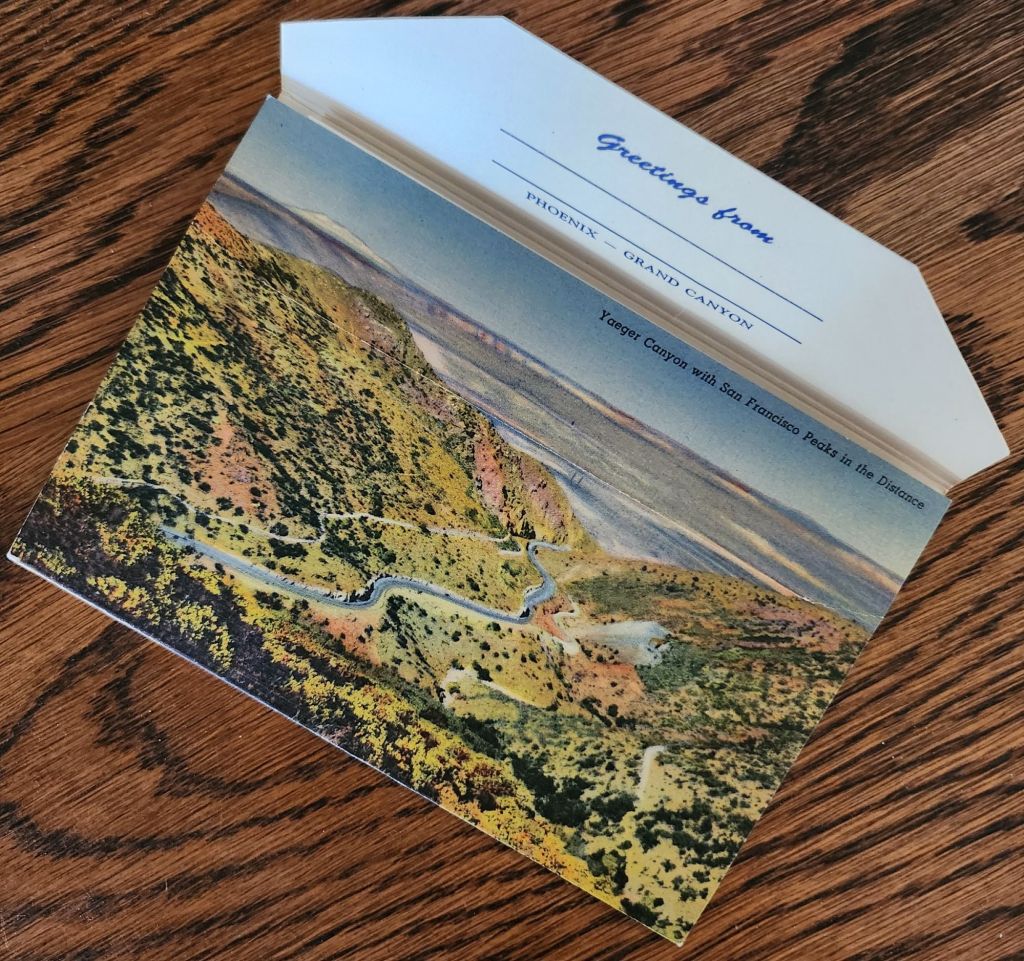
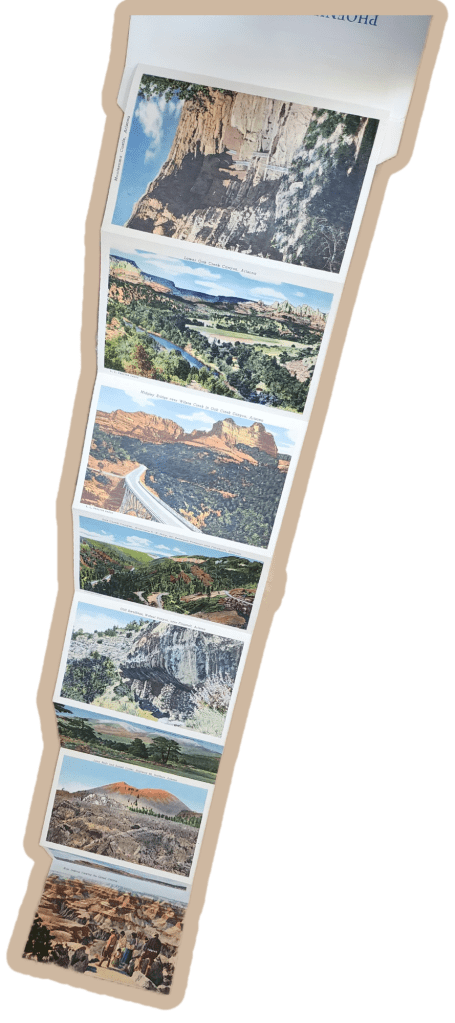
Mid-century postcards captured the wonder of American road trips in vivid color. This Phoenix to Grand Canyon collection reveals the story of car trips, roadside shops, and the natural landscape of Arizona.
Rural Route Arizona
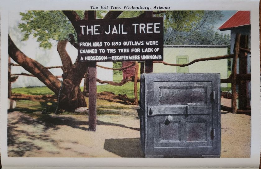
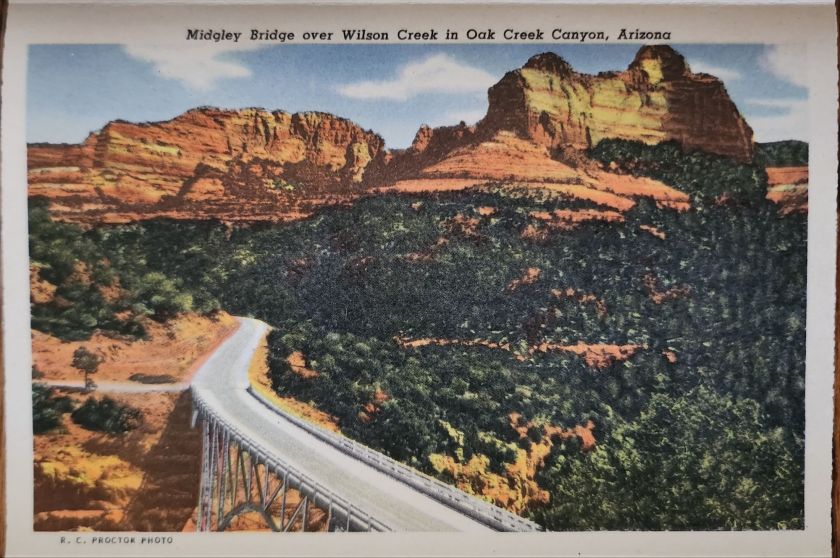
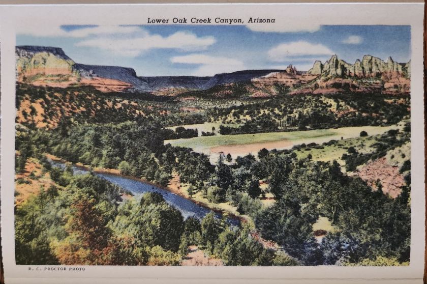
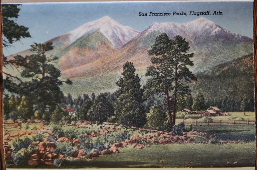
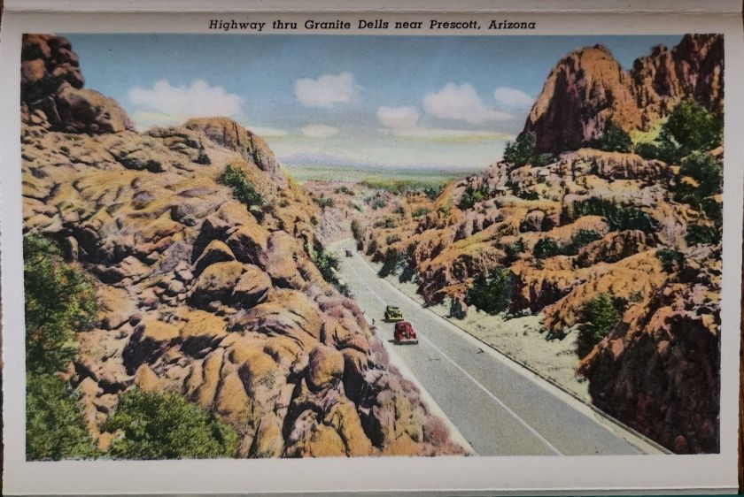
The Phoenix to Grand Canyon route via Oak Creek Canyon carved through America’s most scenic territory. In the 1940s and 1950s, this remained wild, undeveloped country. Starting in Phoenix, travelers navigated winding two-lane roads through Wickenburg, Yarnell, Prescott, Jerome, Clarkdale, Cottonwood, Flagstaff, and Williams.
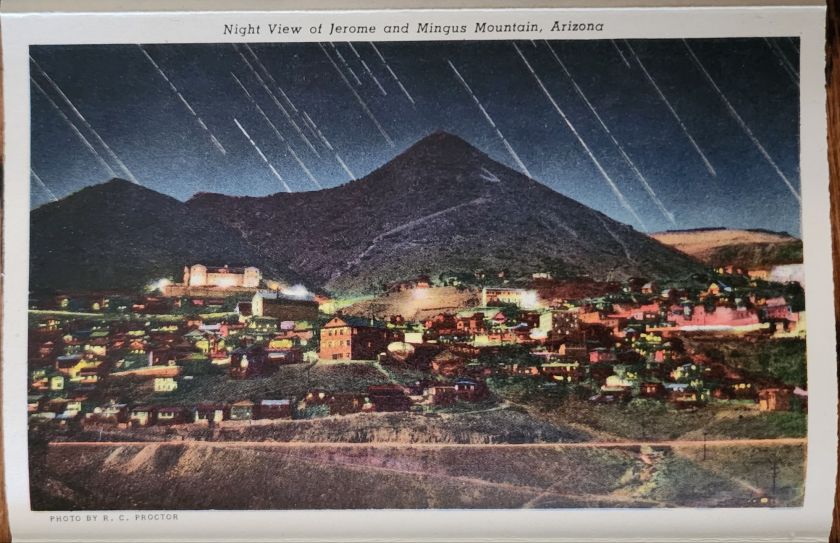
Each stop pulsed with its own character. Jerome clung to mountainsides, mining copper. Prescott sprawled as a ranching center and former territorial capital. Wickenburg lured visitors with dude ranch culture. Williams crowned itself “Gateway to the Grand Canyon.” These weren’t pit stops but destinations, each welcoming tourist dollars from America’s growing car culture.
Postcard Economy
These postcards bear the stamp of Curt Teich & Co., a Chicago printing giant that drove America’s postcard industry from the 1930s through 1960s. German immigrant Curt Teich founded the company in 1898 and revolutionized postcard production. His linen postcards introduced soft textures and blazing colors.
Teich built an industrial empire through local connections. Photographers roamed America, documenting main streets and natural wonders. In Chicago, artists hand-colored black and white photographs, enhancing reality to seduce buyers and ultimately define a social aesthetic.
Behind every postcard rack stood a web of relationships, too. Hotel owners, gas station attendants, and gift shop operators ordered cards from Teich’s catalog or commissioned custom designs featuring their establishments. Postcards advertised businesses, provided affordable souvenirs, and satisfied the social duty to send word home.
Long-distance calls cost fortunes. Letter-writing devoured time. Postcards offered quick connection and proof of adventure. They were quick and easy evidence that the sender had escaped ordinary life for landscapes of impossible beauty. For travelers, buying and mailing postcards proved both pretty and practical.
The typical buyer belonged to America’s emerging middle class, newly mobile through car ownership and paid vacations. Families drove from California to see the Grand Canyon. Retirees took first cross-country trips. Young couples honeymooned across the Southwest. Many experienced the American West for the first time. Postcards helped them process and share encounters with the sublime.
Selecting, writing, and mailing postcards became part of American vacation ritual. Weather beautiful, wish you were here—heartfelt sentiments that bridge extraordinary experience and ordinary communication.
These postcards transcend tourist kitsch. They document a pivotal moment when the West was packaged and sold as leisure destination. Enhanced colors and idealized compositions reflect not just Arizona’s appearance, but how Americans wanted to see it—as endless possibility, natural wonder, and escape from urban routine.
A lone Buffalo Soldier on horseback captures a moment of dignity in African American military history.
Real Photo Postcards (RPPCs) offer tangible connections to history, yet they often emerge from a family photo album or shoebox collection entirely without context. Piecing together their stories requires careful observation and historical research, picking up valuable clues along the way.
Today’s case is an image of a lone Buffalo Soldier on horseback, printed sometime between 1904 and 1918. This postcard captures a moment of dignity in African American military history. The soldier sits tall in the saddle, wearing a formal military dress cap (rather than the campaign hat often associated with frontier service) and a meticulously maintained uniform. The setting—featuring a substantial brick building and cement sidewalk—suggests an established military installation rather than a frontier outpost.
The man is likely from the 9th or 10th Cavalry, and two military posts stand out: Fort Robinson in Nebraska and Fort Myer in Virginia, both important locations in Buffalo Soldier history.
Western Bastion
From 1887 to 1898, Fort Robinson served as Regimental Headquarters for Buffalo Soldier cavalry and infantry units. The 9th Cavalry Regiment made its headquarters there beginning in 1887, serving with distinction and boasting ten Medal of Honor winners from the Indian Wars. The Buffalo Soldiers at Fort Robinson earned a reputation for discipline and effectiveness that would later influence their assignments to more prestigious postings.
The 10th Cavalry Regiment maintained a significant presence at Fort Robinson during the early 1900s. The substantial brick buildings and newly constructed cement sidewalks visible in the photograph align with Fort Robinson’s infrastructure during this period, as the fort underwent significant modernization around this time. The formal dress uniform and cap in the photograph suggest this might have been a commissioned officer or a non-commissioned officer in a ceremonial or garrison role at the fort.
Nation’s Capital
Troop K of the 9th Cavalry served at Fort Myer in Virginia from May 25, 1891, to October 3, 1894, under the command of Major Guy Henry, a Medal of Honor recipient. This prestigious assignment bears a direct link to Fort Robinson. The selection of Troop K for this assignment was a recognition of the outstanding performance at Fort Robinson and other western posts.
The post at Fort Myer was the first time after the Civil War that an African American unit was stationed east of the Mississippi River near a major metropolitan area. The dignified formal pose and military dress cap would be consistent with a soldier stationed at this prestigious posting adjacent to Arlington Cemetery and Washington D.C., where ceremonial duties would have been part of their responsibilities. Both geographic and symbolic, the lauded post demonstrates how the Buffalo Soldiers earned respect through excellence despite pervasive racial prejudice.
While the AZO markings suggest a 1904-1918 printing date for this postcard, it’s possible the photograph itself was taken earlier. Many soldiers had formal portrait photographs taken to commemorate their service, which were later reproduced as postcards. If this soldier served at Fort Myer with Troop K (1891-1894), the image could have been reproduced on AZO stock years later. Alternatively, if the image dates to the 1904-1907 period, it likely shows a 10th Cavalry soldier at Fort Robinson. Without identifying marks or annotations, we can only speculate.
In either case, the photograph reveals a poignant moment during a complex era of American history. The soldier’s strong gaze suggest a person aware of his place in this important legacy. The Buffalo Soldiers’ contributions to American military history invite deeper study, recognition, and remembrance.
Rare panoramic postcards from the Haines Photo Company capture Phoenix on the cusp of the century.
As American cities boomed in the early 1900s, panoramic postcards emerged to document their transformation. The Haines Photo Company of Conneaut, Ohio seized this opportunity, operating from about 1908 to 1917. Photographers crisscrossed the country capturing these distinctive wide-angle views of evolving American cityscapes, like Phoenix, a fledgling desert outpost poised for dramatic growth.
Phoenix in 1900 numbered just 5,554 residents. Though small, it already served as Arizona’s territorial capital with statehood just twelve years away. These panoramic postcards reveal a city establishing the foundation for its explosive future growth.
Washington and First Streets
The first panorama captures Phoenix’s commercial core at Washington and First Streets. Electric streetcar tracks cut through the unpaved road—these trolleys had replaced horse-drawn versions in 1893, modernizing city transit. Desert mountains loom in the distance while palm trees line parts of the street, evidence of successful irrigation in this arid landscape.
A prominent building with a tower dominates the background. Pedestrians stroll the sidewalks alongside horse-drawn carriages, as automobiles remained rare luxuries. Sturdy two and three-story commercial buildings reveal a city with ambitions beyond its frontier origins.
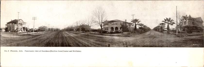
Residences at Center and McKinley
The second view shifts to Phoenix’s growing residential district at Center and McKinley. Here, successful merchants and professionals built impressive homes along wide, unpaved streets. Both palm trees and deciduous trees (some leafless in winter) frame the elegant residences.
These neighborhoods developed as streetcar suburbs, allowing prosperous residents to escape downtown congestion while maintaining business access. Homes display fashionable Colonial Revival and Craftsman styles with generous porches and elaborate details. Unlike cramped eastern cities, Phoenix boasted detached homes on spacious lots—a pattern that would define its future growth.
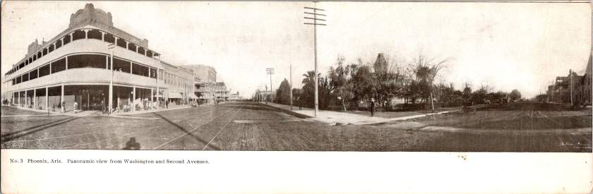
Washington and Second Avenues
The third panorama returns us to the commercial district. A substantial three-story building with multiple balconies dominates the left side. Was it a hotel or major retailer? Streetcar tracks again slice through the broad dirt roadway. A park or green space appears across the street, providing rare desert shade.
Notice the shadow intruding on the lower left? It’s the silhouette of our photographer with tripod-mounted camera. Was this F.J. Bandholtz, a prominent panoramic photographer who worked with Haines?
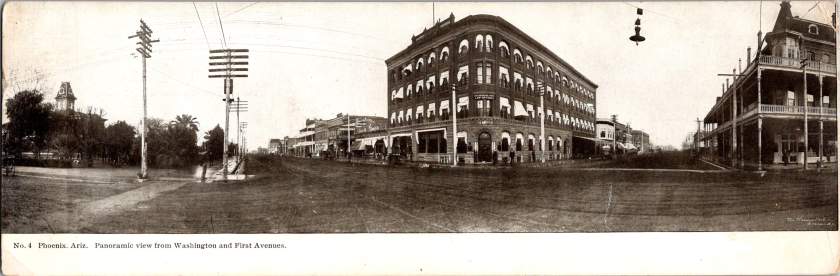
Washington and First Avenues
The fourth panorama captures Phoenix’s financial center. A four-story brick building with numerous arched windows dominates the scene. This building houses the Phoenix National Bank with law offices above, very likely belonging to Joseph H. Kibbey, a former Territorial Supreme Court Justice (1889-1893) and Arizona Territorial Governor (1905-1909).
Founded in 1892, the Phoenix National Bank had become Arizona’s largest by 1899, with deposits totaling $692,166. Telegraph and electrical poles with multiple crossbars line the street, demonstrating developing infrastructure. The dirt streets accommodate both pedestrians and horse-drawn vehicles, though automobiles were beginning to appear.
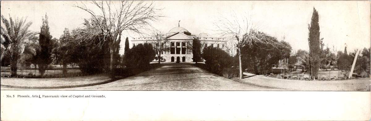
Capitol Grounds
The fifth panorama showcases Arizona’s territorial capitol. This impressive domed structure, completed in 1900 at a cost of $130,000, sits back from the road on a donated 10-acre plot at Washington Street’s western end. Formal gardens with cypress, palms, and ornamental plantings surround the building, irrigation transforming these arid landscapes.
Governor Murphy dedicated the building on February 25, 1901. At the time, the capitol complex embodied Phoenix’s civic ambitions and push toward statehood. Now the main building is home to the Arizona Capitol Museum, connecting present-day Phoenix to its territorial roots.
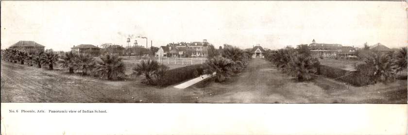
Phoenix Indian School
The final panorama depicts the Phoenix Indian School campus with its multiple buildings, some with smoking chimneys, surrounded by palm trees. Established in 1891, this federal boarding school implemented the government’s brutal and coercive Native American assimilation policies. Located on 160 acres north of downtown, the campus featured brick and frame buildings for classrooms, dormitories, workshops, and administration.
The school expanded rapidly from 42 students initially to 698 by 1900, representing 23 tribes from across the Southwest. Operating until 1990, the school’s complex history reflects the often painful relationship between the federal government and Native peoples, and Phoenix’s role in executing national policies.
The Haines Photo Company
These remarkable panoramic images came from the Haines Photo Company of Conneaut, Ohio. From 1908 for about a decade, they specialized in wide-angle photography of towns and cities across the United States. The Library of Congress preserves over 400 of their photographs documenting America’s evolving landscapes and cityscapes.
Technological innovations in cameras and film made panoramic photography possible. Companies like Haines used specialized equipment to capture expansive views with exceptional clarity. They printed these as postcards for both tourists and locals proud of their developing communities. The panoramic format perfectly suited sprawling western cities like Phoenix that grew horizontally rather than vertically.
Who actually pressed the shutter remains mysterious. The Library of Congress identifies F.J. Bandholtz (Frederick J. Bandholtz, born circa 1877) as a prominent panoramic photographer working with Haines. The shadow in the third image provides our only glimpse of the person behind the camera—a tantalizingly incomplete clue to their identity.
Fast Growth in Phoenix
The early 1900s transformed Phoenix through several key developments. Roosevelt Dam (completed 1911) secured reliable water and power for the Valley. The Santa Fe, Prescott and Phoenix Railway (1895) connected the city to northern Arizona while streetcars improved local mobility. Institutions like the Carnegie Free Library (1908) and Phoenix Union High School (1895) established cultural foundations. Economic activity diversified beyond the “Five Cs” (copper, cattle, climate, cotton, and citrus) to include banking, retail, and professional services.
Statehood on February 14, 1912 elevated Phoenix’s status as capital. These postcards hint at those century-old aspirations—a frontier town rapidly becoming a modern American city. Phoenix’s population doubled from 5,554 in 1900 to 11,134 by 1910, and surged to 29,053 by 1920, launching a growth trajectory that would eventually make it one of America’s largest cities.
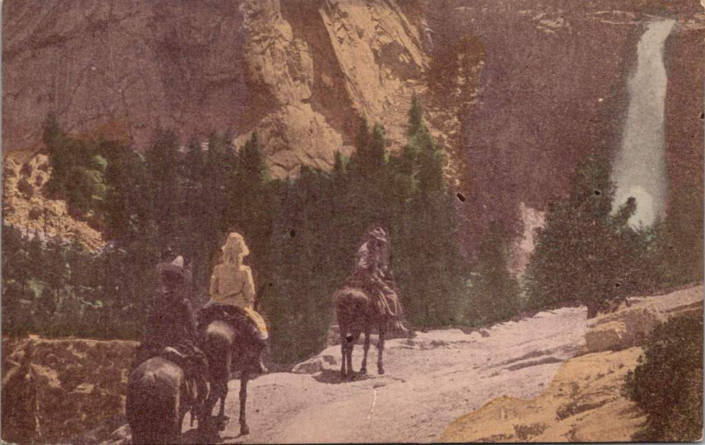
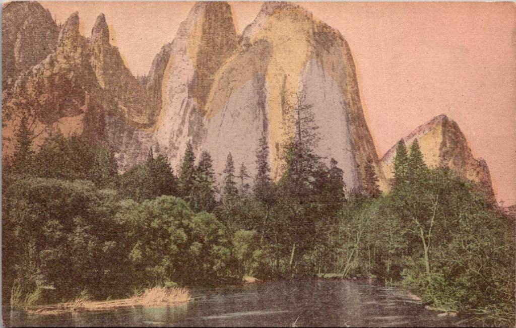
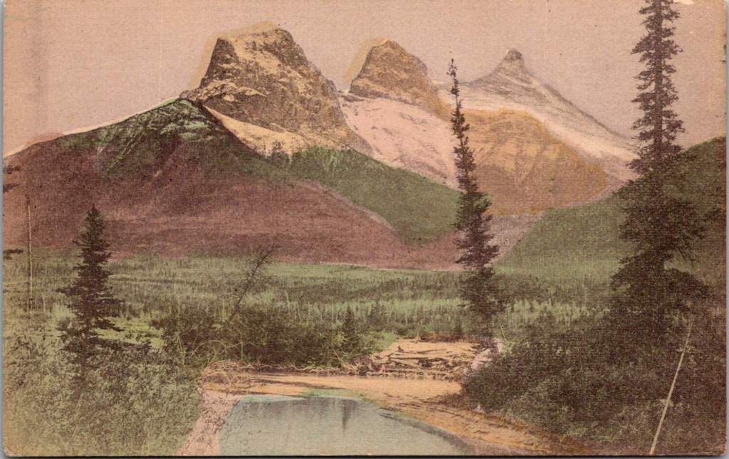
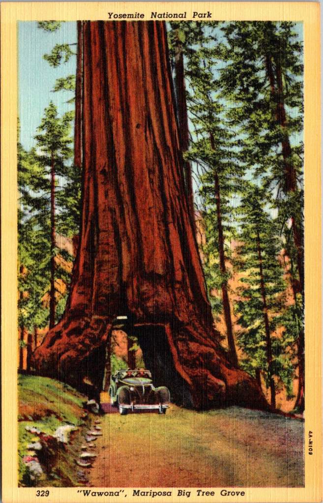
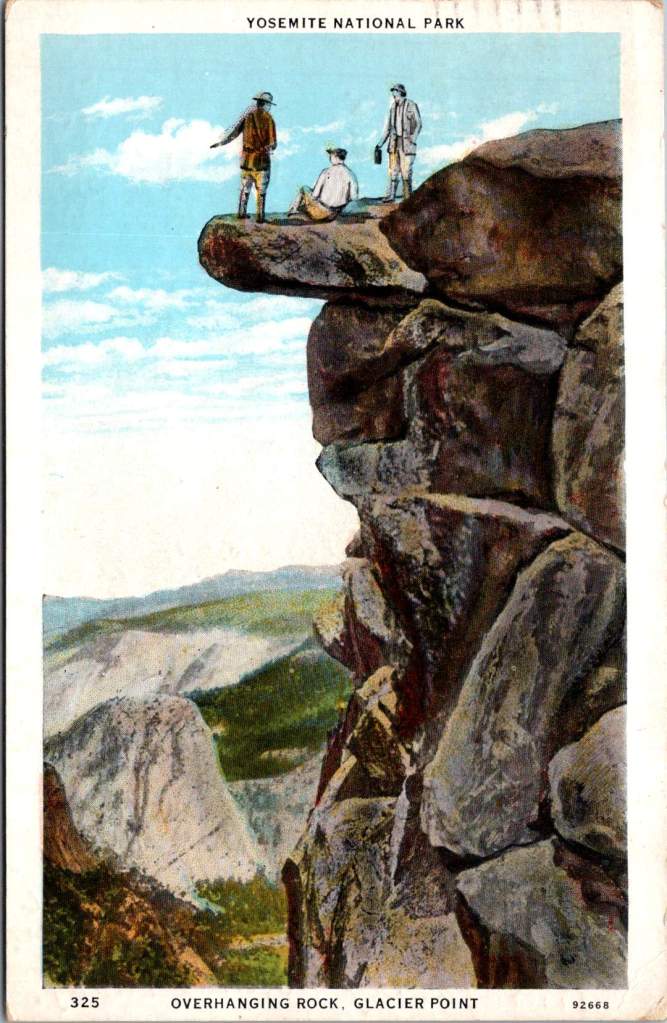
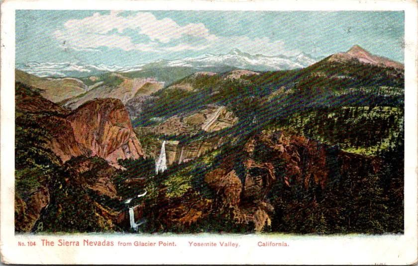
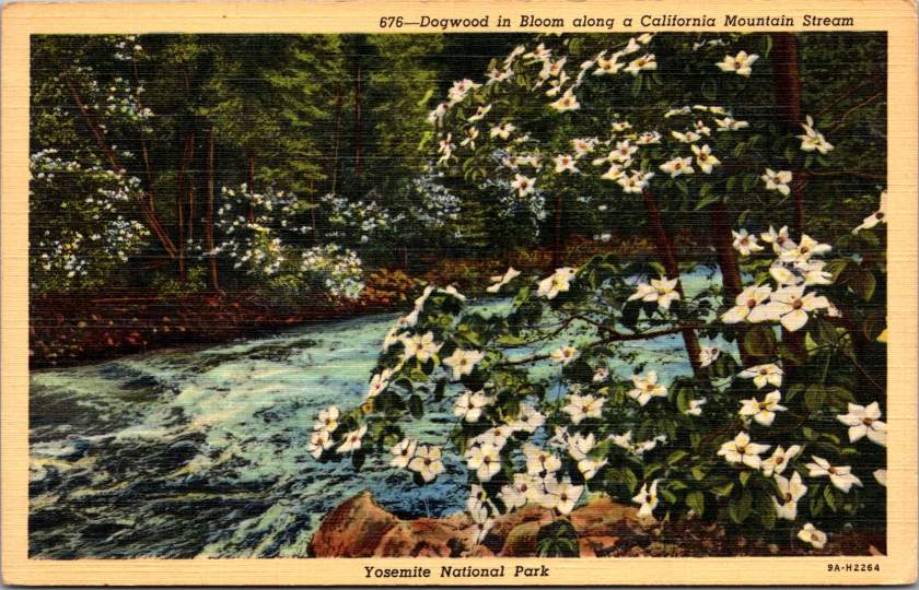
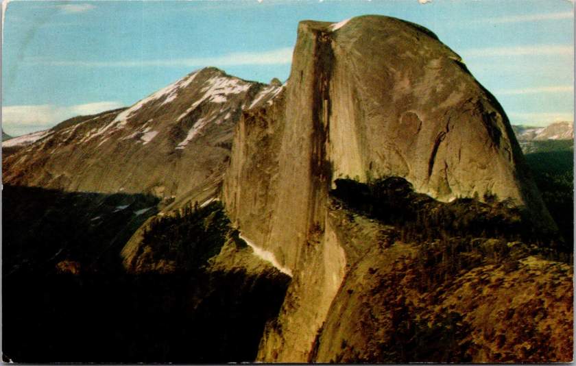
Three figures stand atop Glacier Point in Yosemite Valley, silhouetted against the sky. Horseback riders on a steep mountain trail glimpse a waterfall through the pines. A tunnel carved into a massive sequoia is big enough for a car to pass through. These postcards images tell the story of how Americans fell in love with their national parks.
When Abraham Lincoln signed legislation in 1864 protecting Yosemite Valley, few Americans had seen its wonders firsthand. The journey was arduous, expensive, and often dangerous. But photographs and artistic renderings began circulating, capturing public imagination. Carleton Watkins’ mammoth plate photographs of Yosemite’s towering cliffs and Albert Bierstadt’s luminous paintings suggested something almost mythical: a uniquely American paradise, waiting to be experienced.
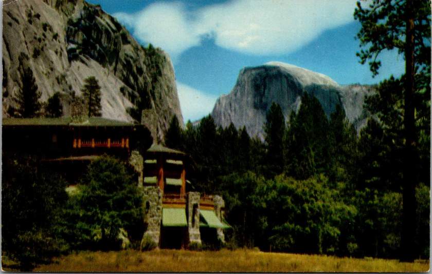
By the 1880s, the Southern Pacific Railroad had begun marketing Yosemite as a must-see destination. Their promotional materials featured romantic images of pristine wilderness alongside luxury dining cars and comfortable accommodations. The message was clear: you could experience the sublime while maintaining the comforts of civilization. The railroad’s campaign to “See America First” tapped into both patriotic sentiment and growing concern about wealthy Americans choosing European vacations over domestic travel.
Stephen Mather, who would become the first director of the National Park Service in 1916, understood the power of imagery. A self-made millionaire from the borax industry, he approached park promotion with a marketer’s eye. Mather encouraged photographers to set up studios in Yosemite and actively supported the production of high-quality postcards, which he called his “little missionaries.” These cards, purchased for pennies and mailed across the country, did more than any official campaign to make Yosemite a part of the American imagination.
The postcards reveal changing patterns in how Americans experienced their parks. Early images show well-dressed visitors on guided tours, often on horseback. By the 1920s, automobiles appear, marking a democratic shift in park access. The famous Wawona Tree tunnel, carved through a giant sequoia in 1881, became a must-have photo opportunity. Each car passing through represented a family making their own way through the park, free to explore at their own pace.
The National Park Service itself emerged from a uniquely American compromise. Progressive Era conservationists like John Muir had argued for pure preservation, while others saw the parks as natural resources to be utilized. The 1916 Organic Act that created the NPS threaded this needle by mandating both conservation and public access – the parks would be preserved unimpaired, but explicitly for the enjoyment of the people.
This dual mandate shaped how Americans came to view their relationship with nature. The parks weren’t distant wilderness to be admired from afar, but rather public spaces to be actively experienced. In the 1930s Civilian Conservation Corps workers built trails and facilities, making the parks more accessible while maintaining their natural character. The message was clear: these were the people’s parks, and the people would help maintain them.
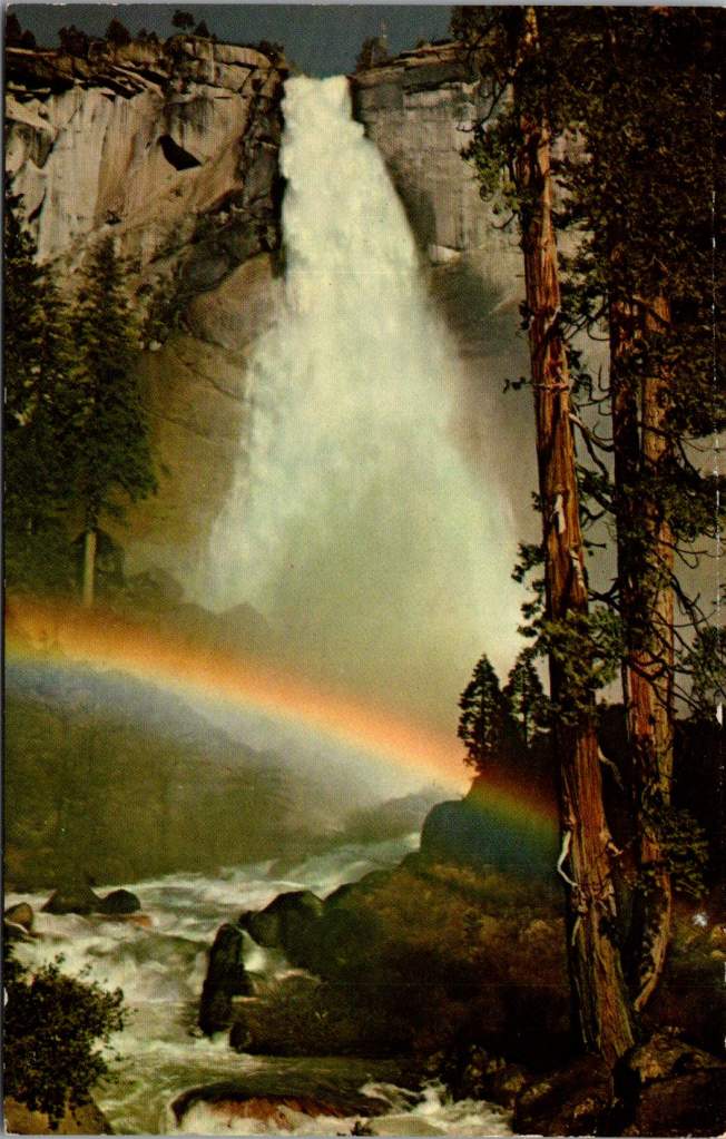
The advent of color photography in the 1940s and 50s brought new vibrancy to park imagery. Postcards from this era capture the brilliant white of dogwood blooms along mountain streams, the deep red of sequoia bark, and the rainbow mist of Yosemite Falls. The images suggested that black and white photography, no matter how artistic, had never quite captured the true glory of these places.
By the mid-20th century, the success of the national parks as tourist destinations began creating new challenges. Bumper-to-bumper traffic in Yosemite Valley became an ironic commentary on Americans’ enthusiasm for their natural heritage. The park service faced growing tension between access and preservation, leading to innovations like shuttle systems and visitor quotas.
Yet the fundamental appeal of the parks remained unchanged. Whether arriving by horse, train, automobile, or tour bus, visitors came seeking what Frederick Law Olmsted had described in his 1865 report on Yosemite, “The union of the deepest sublimity with the deepest beauty of nature.” The parks offered not just scenic views but a connection to something larger than themselves – a uniquely American inheritance.
Today’s visitors to Yosemite might share their experiences through Instagram rather than postcards, but they’re participating in the same tradition of witnessing and sharing America’s natural wonders. The early promoters of the national parks understood something fundamental: seeing these places wasn’t enough. The experience had to be shared to become part of our collective identity.
Those early postcards, with their hand-tinted colors and earnest captions, did more than advertise scenic views. They helped Americans understand these distant wonders as their own inheritance – places that belonged to everyone and therefore needed everyone’s protection. When we look at them today, we’re seeing how Americans fell in love with their national parks, and how that love affair helped define our relationship with the natural world.
The history of Yosemite and the National Park Service reminds us that conservation isn’t just about preserving scenic views. It’s about maintaining spaces where each generation can discover their own connection to the natural world. This fundamental mission remains as relevant as ever. The parks still offer what those early postcards promised: a chance to see the natural wonders of the United States, and to share the experience with friends and family miles away.